If you are relatively new to the concept of wayfinding, these definitions below might be of assistance in understanding the main terms and terminology you will come across in discourse surrounding this subject area.The answer to a number of “what is” questions is answered below:
A
Advance Warning Signs
Advanced Warning Systems are signs designed to provide users with more time to make a decision and to safely stop. These are particularly useful for unexpected stops or for sudden sharp corners when driving.
Ambulant Users
Ambulant users are users who are not wheelchair users but who experience some form of limited mobility. They might, for example, require the aid of a walking stick or not be able to walk far such as because of health issues. In wayfinding, trying to provide easy access becomes important such as via accessible parking.
Architectural Treatments
This term, when used in wayfinding, refers to the way in which you can first look at the built environment (the existing architecture) and how it can be adapted to guide people, rather than necessarily having to put up directional signage.
B
BLE
BLE means Bluetooth Low Energy and is important for indoor navigation, i.e. for wayfinding in interior environments such as airports, shopping malls, and exhibition venues.
When beacons (such as
Blister surfacing
Blister surfacing is a type of surfacing that is used as a form of tactile signage. On paving stones, you often see raised dots within the paving and these will often be placed close to curbs and other locations, where blind or partially sighted users can benefit from feeling the change in paving kinaesthetically.
C
Cardinal Directions
Cardinal Directions are directions that involve the main compass routes i.e. North, East, South, and West. Giving or receiving directions that, for example, tell you to head south and to turn north at the main intersection, would be using cardinal directions.
Changeable Message Sign (CMS)
Cardinal Directions is a sign that is normally electronic and which can change to show different messages. A good example is an electronic parking sign which shows the number of available parking spaces for a motorist.
These signs can also be referred to as Dynamic Message Signs (DMS).
Cognitive Map
A cognitive map is a mental mind map or we could say visual representation, which we use to store information on spatial connections and distances and geographical relationships between locations. As an example, when we visit a new holiday resort, the visual representation in our minds of the place gets clearer each day and more developed.
Context Awareness Service
A Context Awareness Service is a mobile service that helps in understanding the context i.e. the environment of your location and situation and which can aid navigation and the overall experience (more on context awareness).
Corduroy Tactile Paving
This is paving that has patterns on it that can be felt and used as a tactile tool by the visually impaired as this paving is walked on, the paving acting as a warning such as to signify the top or bottom of a staircase or curb.
D
Desire Lines
Desire Lines refers to the trodden paths that we make rather than taking the routes designed, often by ambulatory means.
On a university campus, there may be a pavement, yet you will often see a trodden path across a grass verge. In essence, desire lines are the paths that pedestrians create by taking their own route as a shortcut and normally by foot or by bicycle.
Dibond
Dibond is a common term used when discussing materials for wayfinding signage. Dibond is a popular term in the industry to describe two sheets of aluminum with a solid
Dibond tends to be
Distracted Walking
Distracted Walking is becoming an increasingly popular term (along with ‘Text walking’ ) to describe the way in which people in
Dwell Time
Dwell time in wayfinding and navigation refers to the amount of time we spend in the same place. In terms of wayfinding, increasing the amount of possible dwell time for a passenger, such as in an airport, means that airport managers can make the airport more commercially viable through increased retail spending. Move passengers efficiently such that they have time to spend in the parts of the airport you want them to.
Dead Reckoning
Dead Reckoning involves understanding your present position by analyzing the distance you are from your original point and amount of time spent and your original position.
E
Einstellung Effect
Although not a term specific to wayfinding, this term I have included because I think it can be very interesting within this subject area. The Einstellung Effect refers to how we sometimes use tried and tested methods for doing something, even when a simpler technique can be used.
Environmental Differentiation
The use of colors and other stimuli to create differentiation between environmental factors. For example, a cruise ship might paint each floor a different color to make it possible for travelers to recognize their floor via color coding.
Environmental Visibility
The ability to see the environment and
Equality Rights Act 2010
This act is important in wayfinding because it took over from the Disability Discrimination Act to include the need to make all routes and locations accessible for all users. So in effect, in addition to disabled users, the act also requires that reasonable efforts are made by locations, to also enable the ambulant, those with pushchairs, the elderly, in addition to the fully able-bodied to be able to get around locations in respect of mobility.
F
Field of View (FOV)
Field of View refers to having a clear and visible view of the line or field of sight, i..e you can see the path ahead to be traveled or navigated.
FingerPost Sign
A FingerPost – is a term used in the signage industry for signage that has a tall pole or
Flight Information Displays (FIDs)
FIDs are display boards you see in airports, which detail the arrivals and departures information.
G
Gateway signage
This type of signage is signage that is designed to signify a gateway such as the entrance to a city, an airport, a university or some other large space. Gateway signage, in other words, acts to identify the entrance to what is a large location. A welcome sign, for example, as you enter New York City sign from the Lincoln Tunnel is a great example.
Geo-spatial Information Systems (GIS)
GIS rather than a positioning system is software that manipulates data as part of a framework.
Global Positioning System (GPS)
GPS is a system that can locate specific locations and positions on earth, using satellites. Car SatNavs, for example, use this system.
Gyroscope
A gyroscope is a navigational device that works on an angular basis, which can rotate and detect motion through a three-angled axis spinning device.
H
Heritage Interpretation
See “Interpretive signage” below.
Heuristic wayfinding
Heuristic wayfinding is an expression we use here on travelwayfinding.com in our audits and evaluations to explain a key concept in the way in which many of us
‘Heuristic wayfinding’ refers to a practical and common-sense real-world way of finding solutions to routes, deciding on directions and paths we will take.
We do not, in reality, have time to evaluate every possible route, every option and every outcome, so we
Human Geography
Human Geography can be defined as how people interact and use their physical environment. In wayfinding and navigation, we are dealing with users and how they find their way across, to and through locations, so wayfinding is highly related to the study and field of human geography research and studies.
I
Interpretive Signage (and Interpretive heritage signage)
This refers to a tool for explaining the cultural meaning and value of a given place or attraction. These signs provide an education but also a deeper embodied understanding of the place or attraction in question, often via the use of experiences, artifacts, people and exhibits, and signage.
J
Jaywalking
Jaywalking, written as one word, jaywalking is very much an American phenomenon. The term refers to when you cross a road in the U.S. in an illegal way, such as by ignoring proper crossings and just walking across in the middle of an intersection, rather than at the traffic lights crossing area.
K
Kinesthetic Learning (aka Tactile Learning)
Kinesthetic learning involves learning by experiencing in
Kinetics
Kinetics is the study of movement and motion. Although not specific to wayfinding, this term does sometimes get used in relation to the corporeal aspects of the field.
L
Landmark-Based Learning
Landmark-based learning a route through following man-made and/or natural landmarks including hilltops, tall buildings, monuments, and other sites visible such as from a survey point of view.
Legible Signage
Lebigble signage might be easy to read from a certain distance, but can it be read from different distances; can the information be digested on a practical level; and can it be read by users of different abilities such as those who are colour blind or those sat in a wheelchair? Legible is about how readable signage really is.
Location Awareness
Location awareness is when a product such as a SatNav can work out its own location. In the case of a SatNav, this geographical location is then used to guide you to your desired end location.
Location Based Services (LBS)
LBS is a computerized system for using the location of a user to affect a certain program. If you imagine Facebook, they can send you targeted ads according to your location. LBS though is also becoming increasingly useful in wayfinding and navigation.
Level of Service (LOS)
LOS is not specific to wayfinding but pertinent to this field of study. It can be a very valuable exercise to undertake LOS surveys frequently in tourism spaces such as an airport, to evaluate and to get a good understanding of the efficiency of your wayfinding system.
M
MUFIDS
MUFIDS is a term that refers to Multiple User Flight Information Display Systems, an example being the electronic departures or arrivals board at an airport.
Markov Decision Process (MDP)
Although not a term specific to wayfinding or navigation, an MDP process is sometimes used in analyzing route decisions. The main concept behind the Markov process is that decisions are often a combination of the traveler’s decision-making and partly based on other, random factors. MDP provides a mathematical equation and paradigm for analyzing routes which involve random and personal decisions.
N
Nomenclature
Nomenclature is important in wayfinding signage design. Nomenclature refers to the way we name things i.e. the strategy and technique we use for naming conventions. This is important in wayfinding because it relates to how we, for example, name things in signage. Do we use the term ‘Underground’ or ‘Metro’ when naming a rail system and how will each choice provide clarity of not to users?
Nosings
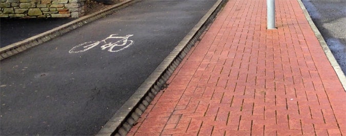
A nosing is the edge of a step or curb and is a term that you will see used when DDA and accessibility audits are discussed. Nosings should contrast with the rest of the step so that those with visibility issues can more easily view the edge of steps.
P
Path of Least Resistance
This is a term mostly used in physics but it can also be applied to wayfinding studies. To give an example, hikers who are walking over a set of hills will very often look for and use the path of least resistance. That is the route that provides the least physically demanding and might mean walking through the valley rather than over a hill (to give a very simple sample). Thrill-seeking
Perpendicular Signage
Perpendicular signage refers to signage that stands tall i.e. is designed as vertical signage. A good example is a pillar which is emblazoned with directional information on it.
Personal Navigation System (PNS)
This type of system is the natural progression from GPS technology, with a personalized service using wireless and mobile technologies.
Placemaking
What is placemaking? This is the design, planning, human Geography related, and management of small to medium spaces in order to create benefits for the people who use these spaces. Integrating artistic features into
Point of Interest (POI)
Another similar term and alternative to the word landmark. The term differs from landmarks though in its use in sectors such as the medical industry, where it can refer to a particular area of interest set against a background, one example being when an optometrist tests your eyes.
R
Radio-frequency identification RFID
RFIDs in effect is a way of using small detectable devices that use an antenna or a small chip to read or transit data. From
Reverse Perspective
In terms of wayfinding, this expression was used by Erik Cohen to express the way in which we can draw cognitive maps of a place, and we
Risers
Risers in wayfinding
Route Angularity Effect
Research has found that routes with many angles are perceived to be longer than they actually are because of the angles i.e. the turn around a number of corners.
Route Based Learning
See the definition below (Route Knowledge and Strategy)
Route Knowledge and Strategy
Navigating somewhere based on quite precise directions such as turn left and take
S
Shoreline
In wayfinding, shoreline, refers to a clear outline along or through a part or all of a building.
Slow Tourism
This relatively new term and concept, and which originates from the idea of slow food, is generally about not rushing to travel somewhere and taking the time to enjoy the journey.
Engaging with local communities is also included in some definitions of slow tourism. For many, cruise holidays typify the meaning of slow tourism in that the journey and slowly getting somewhere and appreciating the journey itself, and taking time to enjoy the open seas, rather than rushing to fly somewhere, is a great example. Cruise travel, on the other hand, completely contradicts what some people see as slow tourism because some advocates of slow tourism emphasize the avoidance of mass tourism. As you can see, the term is somewhat complex in meaning and is a term that is debatable according to one’s ontological views.
Steering Behavior
This is a form of wayfinding and navigation that is based on the intentional attempt to draw people into or towards a location. An example is a vendor in an airport finding ways to draw people into their shop, by finding ways to affect the routes.
Survey Knowledge and Survey Directions
Using an overall view of the area and often using what can be seen using an aerial view.
T
Tactile Ground Surface Indicators (TGSI)
TGSI’s are invaluable for helping those with disabilities such as those with visual sight problems to navigate. Through the design of features such as paving stones which have a tactile surface, such as rough edges on each step or a kerb gives the user a sign to read the environment. TGSIs are, in other words, a way we can give those with sight problems environmental clues as they wayfind. You may yourself have experienced tactile surfaces on motorways whereby the road becomes harder on your wheels and makes a noticeable noise if you stray onto the edge inside the inside lane.
Totems
Totems are used to describe wayfinding signage which comes in the form of tall and sturdy vertical stands which are generally quite inexpensive and adaptable.
Trajectory
The path or route that an object takes.
U
UX Design
UX (User experience) design in wayfinding is all about guiding users such that they have a positive experience. If you manage an airport, for example, no doubt that you want users to re-use your location in the future. There are different techniques for working towards creating
Universal Design
In wayfinding, this term refers to design that makes locations accessible for all users, that is, for the able-bodied, elderly, ambulant, children, those with pushchairs, wheelchairs etc.
V
Visibility Index
Is a way of measuring the lines of sight in a quantitative way, for the planning and evaluating of wayfinding design.
Visual Access
Visual access refers to the level to which we can see different parts of an indoor or outdoor space from the point at which we are. On entering a building, for example, the degree to which we can comprehend and have a sense of our
W
Wayfaring
Wayfaring, as opposed to wayfinding, wayfaring refers to finding your way between places but specifically by foot, i..e by perambulatory movement and means. So walking routes, paths that are taken, for example, along country paths or through urban areas tend to be of interest in wayfaring studies and planning. Wayfinding, on the other hand, refers to all forms of transport in how we find our way between places, including by foot.
Wayfinding
Wayfinding is “the cognitive, social, and corporeal process and experience of locating, following or discovering a route through and to a given space.” (Symonds et al, 2017). You can also learn more about what is wayfinding here.
Wayside
Wayside is a term sometimes used, particularly in America, to refer to the design of interpretive signage that exists as you walk by, such as on heritage trails and bay trails.
Way-Signing
Way-signing is NOT a commonly used term but it is one I have heard used now and again, so it is worth perhaps mentioning. Some people who are not familiar with wayfinding see this subject area as being about directional signage. Wayfinding, of course, is a much more complex subject area and includes, for example, the use of space and design.
If a town, for example, uses space well and has a landmark that can be seen from most points, then the need for signage is decreased and natural paths are much easier to follow. It is important to get away from thinking of wayfinding as just about directional signage in order to fully understand this subject area.


